COLOMBO, November 19, 2026 — A mobile service designed to help Sri Lankan fishermen locate promising fishing grounds has come under scrutiny after the Government claimed it was being used by 100,000 people and that Rs. 1 billion had been allocated for improvements. Official records confirm the technology exists, but leave important questions about its users, accuracy and funding unanswered.
A Government claim that approximately 100,000 fishermen are using a mobile application to identify promising fishing grounds has prompted questions about the reliability of its forecasts, the evidence supporting its reported popularity and the proposed expenditure of Rs. 1 billion in public funds.
Deputy Minister of Fisheries, Aquatic and Ocean Resources Rathna Gamage told Parliament on November 13 that the application was operational and already serving around 100,000 fishermen.
He also announced that Rs. 1,000 million had been allocated in the 2027 Budget to improve the system, which reportedly provides fishing information covering a period of two to three days.
The statement followed public criticism of earlier remarks by President Anura Kumara Dissanayake concerning the use of digital technology to identify areas where fishermen could obtain better catches.
Although the subject has attracted considerable political commentary and social media ridicule, official documents show that Sri Lanka already operates a scientifically based fishing-ground advisory service.
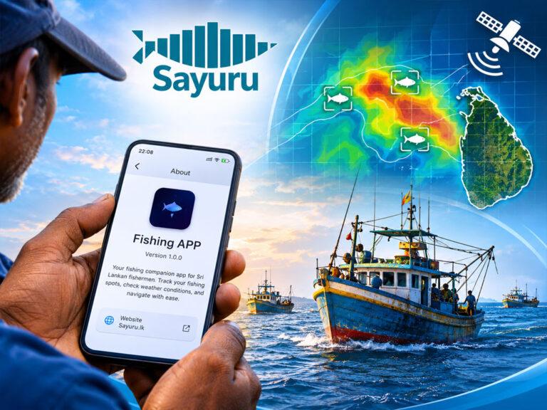
The National Aquatic Resources Research and Development Agency (NARA) uses satellite observations and oceanographic models to identify areas potentially suitable for catching tuna. Its forecasting information has also been integrated into Dialog Axiata’s Sayuru mobile application.
What remains unclear is whether the Government’s reported 100,000 users represent downloads, registrations, active users or fishermen whose identities and actual use of the forecasting service have been verified.
A second question concerns the Rs. 1 billion announced by the Deputy Minister. The published Budget identifies an allocation of that amount for a broad fisheries resource management programme rather than specifically for upgrading a mobile application.
Those distinctions are important because public investment in fishing technology should be assessed not by political claims or download statistics, but by its measurable benefits to the fishing community.

How Fish-Finding Technology Actually Works
The use of scientific information to identify productive fishing grounds is well established internationally.
Satellite observations can help researchers identify ocean conditions associated with the distribution of particular fish species.
These systems analyse factors such as sea surface temperature, chlorophyll concentration, ocean currents, sea surface height and other environmental conditions.
Fish do not inhabit the ocean uniformly.
Their movements depend on water temperature, salinity, depth, food availability, nutrients, currents and seasonal migration patterns.
Different species favour different conditions, meaning a location suitable for one species may not be equally productive for another.
Chlorophyll data, for example, can indicate areas with increased phytoplankton activity and potentially productive marine food chains.
It does not directly establish that commercially valuable fish are present at a particular location.
Likewise, favourable water temperatures and ocean currents may increase the probability of encountering particular fish species without guaranteeing a catch.
A satellite-based fishing forecast is therefore a prediction of potentially productive fishing areas, not a live image showing the precise location of fish.
This distinction is particularly important when comparing satellite forecasting with sonar systems installed on fishing vessels.
Sonar can detect objects and potentially fish schools within its operating range, but it cannot continuously survey an entire ocean.
Satellite forecasting offers a wider geographical assessment, while onboard instruments can provide information closer to the vessel.
Used together with a skipper’s experience, recent catch information and prevailing sea conditions, the technologies can improve fishing decisions.
Their usefulness ultimately depends on the quality of the data, the accuracy of the models and how quickly forecasts are updated.
NARA’s Official Report Confirms an Existing Forecasting Service
Sri Lanka’s fishing-ground advisory system is not merely a proposed application or an untested political concept.
The Ministry’s 2025 progress report describes an operational Tuna Fishing Ground Advisory and Fisheries Information Service managed through NARA.
Its objective is to improve the efficiency of multi-day fishing vessels by identifying potentially productive areas and reducing unnecessary time spent searching for fish.
The programme focuses particularly on three commercially important tuna species: yellowfin tuna, bigeye tuna and skipjack tuna.
NARA uses satellite data, including sea surface temperature, sea surface height and chlorophyll observations, together with global ocean models to prepare fishing-ground advisories.
By August 31, 2025, the programme had issued:
| Tuna species | Advisories issued |
|---|---|
| Yellowfin tuna | 84 |
| Bigeye tuna | 30 |
| Skipjack tuna | 72 |
| Total | 186 |
The service distributed these forecasts through messaging platforms, email and social media.
Importantly, the official report also confirmed that NARA had collaborated with Dialog Axiata to integrate Potential Fishing Zone information into the Sayuru mobile application.
That establishes the existence of a mobile channel through which fishermen can access scientific forecasting information.
It does not establish that the number of active users reached 100,000.
Official Audience Figures Do Not Confirm 100,000 Users
NARA’s 2025 report provides figures showing how its fishing-ground advisories were distributed by August 31, 2025.
REPORTED ADVISORY DISTRIBUTION · AUGUST 2025
1,600 :-WhatsApp users
380 :-Email subscribers
2,700 :-Facebook followers
Source: Ministry of Fisheries 2025 Progress Report. These are audience figures across different channels, not a count of unique active app users.
The three figures add up arithmetically to 4,680, but it would be incorrect to describe them as 4,680 individual fishermen.
The same person may subscribe through multiple channels, while some Facebook followers may be researchers, officials, students or members of the general public.
Nor can the figures be treated as the total audience of the Sayuru application, since the report does not provide a complete count of that platform’s users.
They also relate to August 2025, more than a year before the Deputy Minister’s November 2026 statement.
A substantial increase in users during that period is possible.
What is missing is the official evidence demonstrating that such growth occurred.
If the Government maintains that approximately 100,000 fishermen currently use the application, it should publish the data and explain how the figure was calculated.
NARA Secretary Acknowledged 50–60% Forecast Accuracy
The accuracy of Sri Lanka’s fishing-ground forecasts had already become a matter of concern before the latest parliamentary debate.
On August 9, 2026, The Sunday Morning reported comments by Ministry Secretary Dr. B. K. Kolitha Kamal Jinadasa acknowledging that the existing NARA forecasting system achieved an estimated accuracy of 50–60%.
He attributed the limitation partly to the insufficient spatial resolution of freely available satellite data.
According to the report, discrepancies between predicted and actual productive fishing areas could extend to approximately 50 kilometres.
Such a variation is financially significant for fishing vessels.
A boat travelling additional distances in search of fish consumes fuel, requires more operating time and may incur higher labour and maintenance costs.
For vessels already operating on narrow profit margins, an inaccurate forecast can reduce or eliminate the economic benefits expected from the technology.
Nevertheless, the reported accuracy figure does not mean the system is useless.
Forecasts are intended to narrow the search area, not guarantee that fish will be found at a particular location.
Even an imperfect forecast may improve decisions if it performs better than searching without guidance.
The crucial question is how the reported accuracy was measured.
Officials should explain the evaluation method, the reference data used and whether the assessments reflect real fishing outcomes.
Without that information, a percentage alone provides limited insight into the actual value of the service.
Indian Satellite Data Could Improve Forecasts
NARA has been working to improve its forecasting capability through cooperation with the Indian National Centre for Ocean Information Services (INCOIS).
According to the August report, INCOIS agreed to provide relevant satellite and oceanographic data to Sri Lanka free of charge.
The arrangement is intended to help NARA access more detailed information for forecasting potential fishing grounds.
The Ministry Secretary also explained that funding previously earmarked for obtaining higher-resolution data could instead support improvements to NARA’s data-processing infrastructure.
These upgrades include computer servers and other equipment necessary to process larger volumes of oceanographic information.
Tender procedures for the equipment had reportedly been initiated.
Such improvements could increase the forecasting service’s usefulness, although better input data alone cannot guarantee more accurate results.
Models must still be validated against fishing activity, historical catches and observed conditions.
The exchange of data with India represents an opportunity to strengthen Sri Lanka’s scientific capability without having to develop every component independently.
It also makes transparency over expenditure especially important.
If some valuable data can be obtained without licensing charges, the Government should explain which infrastructure, software, research and operational costs will require public funding.
Sayuru App and Proposed New Platform Must Be Distinguished
The discussion has also exposed uncertainty over which application the Government is referring to.
NARA’s scientific forecasts already reach fishermen through several channels, including Dialog’s Sayuru app and the agency’s Facebook page.
The Ministry Secretary said in August that NARA was providing fishing-ground forecasts three to four times a week.
He also indicated that a dedicated application was being considered.
Those statements suggest the existence of distinct components within the broader service: NARA’s forecasting system, its integration with Sayuru and the possibility of a separate government application.
They should not automatically be described as the same product.
A newer report published on November 19 quotes NARA scientist Sudheera Gunasekara as saying that Rs. 100 million had been allocated for developing a mobile application covering yellowfin, bigeye and skipjack tuna forecasts.
The report also records concerns from multi-day boat owners about the effectiveness of earlier forecasting arrangements.
The Rs. 100 million figure introduces a further distinction from the Deputy Minister’s reported Rs. 1 billion allocation.
It remains necessary to establish whether these announcements refer to separate projects, different funding components or differing descriptions of the same programme.
Until those details are clarified, neither figure should be described as the confirmed final cost of a specific mobile application.
FAO Study Reveals Barriers to Digital Adoption
The technical effectiveness of a forecasting system is only one part of its value.
Fishermen must also have the equipment, connectivity, knowledge and confidence necessary to use the information.
Research by the Food and Agriculture Organization of the United Nations (FAO) at Nilwella Fisheries Harbour in Matara District provides an important illustration of these challenges.
The FAO’s Digital Villages Initiative found that many fishermen in the area preferred ordinary mobile phones to smartphones.
Frequent contact with seawater, fish and wet working conditions made the use of more sophisticated devices less convenient.
Digital connectivity was available, but the quality of internet access varied.
Some applications remained in pilot stages and were used mainly by a relatively small group of people comfortable with digital technology.
The study also identified limited trust in information provided by government agencies as an obstacle to wider adoption.
Building confidence required more than simply making forecasts available.
Fishermen needed to understand where the information originated, how predictions were produced and how they could be applied during actual fishing operations.
The FAO suggested using digitally knowledgeable young people to help explain the technology and support other members of the community.
Training and practical demonstrations could also encourage greater acceptance.
At the same time, the organisation recognised the potential economic benefits.
For multi-day fishing vessels spending between 10 and 30 days at sea, advance information about promising fishing grounds could reduce unnecessary searching and improve operating efficiency.
These observations are relevant to the national discussion, although findings from Nilwella cannot automatically be generalised to every fishing community in Sri Lanka.
Fishing practices, vessel types, income levels and access to digital technology vary across the country.
Communities along the western coast, including the Chilaw and Negombo fishing belt, also warrant assessment to determine whether similar barriers exist.
Community and religious organisations with longstanding relationships among coastal fishing families could contribute to awareness and training, but their precise involvement should not be assumed without evidence.
The broader lesson is that a successful digital fisheries programme requires practical support and user confidence alongside technological development.
Downloads, Registrations and Active Users Are Different
The Government’s claim of 100,000 users cannot be assessed meaningfully without knowing what constitutes a user.
Four commonly used measures are particularly important.
| Measure | What it establishes |
|---|---|
| Downloads | How many times the application was installed |
| Registered users | How many accounts were created |
| Active users | How many users accessed the service during a defined period |
| Verified fishermen | How many users have confirmed identities linked to the fishing industry |
These figures are not interchangeable.
One individual may install an application on several devices or create more than one account.
A registered user may cease using a service, while somebody who views a forecast through Facebook or WhatsApp may never open the mobile application.
Monthly active users provide a stronger indication of engagement than downloads alone, but even that measure does not prove that the application improved fishing outcomes.
For the parliamentary claim to be independently assessed, the Ministry should disclose the number of registered accounts, daily and monthly active users, and the proportion verified as fishermen.
It should also explain whether the claimed audience includes people accessing NARA’s information through other digital channels.
More importantly, officials should measure the number of fishermen who found the forecasts useful in making decisions at sea.
A government service does not become successful merely because people have downloaded it.
Rs. 1 Billion Budget Allocation Requires Clarification
The most consequential financial question concerns the Rs. 1 billion referred to by Deputy Minister Rathna Gamage.
According to reports of his November 13 parliamentary statement, the Government had allocated Rs. 1,000 million in the 2027 Budget to improve the application.
He said the existing system provided data for a limited period and that discussions were underway with foreign companies and local service providers concerning improvements.
The published 2027 Budget, however, identifies Rs. 1,000 million for sustainable fisheries resource management.
The activities covered by that allocation include ocean surveys, aquatic habitat mapping, assessments of fish resources, collection of monitoring data, laboratory analysis and ecosystem restoration.
These are broader scientific and environmental activities.
The Budget passage does not identify the full Rs. 1 billion as funding exclusively reserved for a mobile application.
That distinction does not establish that the Deputy Minister misstated the allocation.
It does mean that a clear reconciliation is needed between his parliamentary remarks and the published expenditure proposals.
If the Rs. 1 billion covers several fisheries research and management activities, presenting the entire amount as the cost of improving a phone application would misrepresent the programme’s scope.
If a separate Rs. 1 billion has genuinely been earmarked for the application, the Government should identify the relevant budget line and supporting project documentation.
The separate report of Rs. 100 million for app development makes this clarification even more necessary.
A broad budget allocation, an approved project estimate, a procurement award and an actual payment are four different financial stages.
They should not be treated as equivalent.
Public Deserves a Detailed Explanation of the Project
Before a major public expenditure commitment is finalised, the Ministry should publish the information necessary to assess its purpose and likely benefits.
The important questions include:
- What is the official name of the existing fishing application, and which institution is responsible for its ownership, administration and maintenance?
- How was the figure of 100,000 users calculated, and how many of those users are active fishermen?
- How many people access forecasts through Sayuru, WhatsApp, email and Facebook, and how much overlap exists between those audiences?
- Has the reported forecasting accuracy of 50–60% been independently tested against actual catches and vessel movements?
- Has the technology demonstrably reduced fuel expenditure, search time or unproductive fishing trips?
- What improvements are proposed for 2027, and what are the corresponding technical specifications and estimated costs?
- Does the Rs. 1 billion mentioned in Parliament refer to the broader fisheries resource management allocation, a dedicated application project or another programme?
- How does the separately reported Rs. 100 million application development allocation relate to the wider budget?
- What procurement arrangements will govern the selection of software developers, data providers and technology partners?
- How will the service accommodate fishermen using smaller coastal vessels and those undertaking multi-day deep-sea operations?
Answering these questions would help establish whether the proposed investment is proportionate to the results expected.
It would also protect the credibility of the programme by replacing political claims with measurable evidence.
Transparency should be regarded as part of implementing a successful public technology project, not as an obstacle to it.
Real Value Lies in Reducing Fishing Costs
Sri Lanka’s fisheries industry supports the livelihoods of thousands of families and contributes to national food security.
Each fishing trip involves financial commitments that must be recovered through the eventual catch.
Fuel, ice, food, crew wages, vessel repairs and maintenance all contribute to operating costs.
For multi-day vessels, those expenses can become substantial.
A trip that produces a poor catch may leave the vessel owner and crew with little income despite considerable time and expenditure.
Reliable fishing-ground forecasts could help reduce these risks.
If fishermen can identify promising areas more efficiently, they may spend less time travelling without productive catches.
Improved information could also assist with trip planning and the management of fuel supplies.
However, the value of such a service needs to be demonstrated through field evidence.
Comparisons between vessels using forecasts and those operating without them could help determine whether the application provides measurable financial benefits.
Researchers should examine actual fuel consumption, catch per unit of effort, time spent searching and the reliability of forecasts across seasons.
It is also important to recognise that a fishing-ground prediction is not a maritime safety warning.
Information suggesting that fish may be present in a particular area does not establish that conditions are safe for a vessel to operate there.
Weather forecasts, sea-state information and maritime hazard alerts remain essential.
Integrating these services could improve the application’s usefulness, provided fishermen can clearly distinguish fishing advice from safety information.
Different types of vessels may also require different services.
Small coastal boats operate under different conditions from offshore vessels spending several weeks at sea.
An effective digital system must reflect those practical differences rather than assume a single solution will meet every fisherman’s needs.
Technology Must Be Judged by Results, Not Political Claims
The dispute over Sri Lanka’s fishing application should not obscure the scientific value of the underlying technology.
NARA’s official records establish that a fishing-ground advisory programme exists and that its forecasts have been made available through Dialog’s Sayuru platform.
The Ministry has acknowledged weaknesses in forecasting accuracy and is pursuing improved oceanographic data and processing infrastructure.
Those developments provide a legitimate foundation for modernising the country’s fishing industry.
Yet several questions remain unanswered.
The public has not been provided with independently verifiable statistics demonstrating that 100,000 fishermen actively use the application.
The financial relationship between the Deputy Minister’s Rs. 1 billion announcement, the broader fisheries resource management allocation and the separately reported Rs. 100 million application development proposal also requires explanation.
The Government should publish the relevant figures and technical documentation.
Opposition politicians have a responsibility to examine those records and challenge unsupported claims without dismissing scientifically established forecasting methods.
The media, in turn, must distinguish legitimate scrutiny from ridicule that misrepresents what the technology is designed to accomplish.
Ultimately, the most important measure of success will not be the number of people said to have installed an application.
It will be whether fishermen can return from the sea having spent less on fuel, wasted fewer hours searching and improved their earnings without compromising safety or the sustainability of fish stocks.
For an industry on which so many families depend, that is the standard against which public investment should be judged.