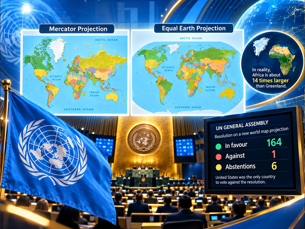
Equal Earth projection gains overwhelming UN backing as countries support a more accurate way to show the true relative size of continents.
The Equal Earth projection has won overwhelming support at the United Nations, challenging the centuries-old Mercator map that remains widely used across the world.
The United Nations General Assembly voted by 164 votes to one in favour of a resolution promoting a world map projection that more accurately reflects the relative size of continents.
Six countries abstained from the vote.
The United States was the only country to vote against the resolution.
Togo led the initiative with support from other African states, placing a longstanding cartographic debate firmly on the international agenda.
The UN-backed proposal promotes the Equal Earth projection, which reduces some of the severe size distortions created by the Mercator projection.

Why the Equal Earth Projection Is Being Promoted
The Mercator projection dates back to the 16th century.
It remains widely used because of its practical value for navigation, particularly at sea.
However, the projection significantly exaggerates the apparent size of land masses closer to the poles.
One of the clearest examples is Greenland.
On many Mercator maps, Greenland can appear almost comparable in size to Africa.
In reality, Africa is around 14 times larger than Greenland.
The Equal Earth projection reduces that visual distortion.
As a result, it gives viewers a more accurate understanding of the relative area of continents and countries.
The initiative does not suggest that the physical world itself has changed.
Instead, it addresses how the curved surface of Earth is represented when converted into a flat map.
UN Vote Does Not Change National Borders
The UN resolution does not redraw international borders.
It also does not move countries, alter territorial boundaries or change their geographical positions.
The change concerns map projection only.
The resolution is also not legally binding.
Countries, schools, companies and mapping organisations are therefore not required to stop using the Mercator projection.
The UN initiative also recognises that Mercator remains useful for maritime and aerial navigation.
Its straight-line navigational characteristics are one reason the projection has remained important for centuries.
The debate is therefore not about completely abandoning Mercator.
Instead, it concerns whether other projections should be used more widely for education and general geographic representation.
Why Africa Is Central to the Debate
Togo has played a leading role in promoting the Equal Earth projection as part of a wider African campaign for more accurate representation.
For decades, critics of the Mercator map have argued that it visually understates Africa’s enormous geographical scale.
At the same time, land masses closer to the poles can appear much larger than they actually are.
Supporters of the new initiative argue that this can influence how people understand the relative size and importance of different parts of the world.
Togo plans to introduce the Equal Earth projection into school geography materials by the end of 2026.
The country is also expected to encourage other governments, educational institutions and technology companies to consider adopting it.
That gives the vote significance beyond technical cartography.
It has become a discussion about geography, education and how generations of students visually understand the world.
A Different Way of Seeing the Same World
The overwhelming UN vote gives the Equal Earth projection greater international visibility, but it does not establish a compulsory global map.
The Mercator projection will continue to have important uses, particularly in navigation.
However, the new initiative may encourage more schools, publishers and digital platforms to use projections that preserve the relative size of land areas more accurately.
The debate ultimately demonstrates how much influence a map can have on perception.
The continents have not changed.
International borders have not moved.
But after the United Nations backed the Equal Earth projection by 164 votes to one, the way millions of people see the world on a flat map could gradually begin to change.