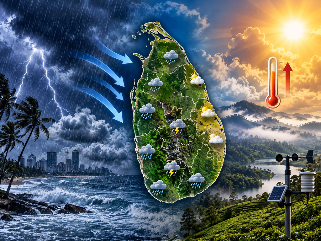
Sri Lanka weather is showing signs of a seasonal shift as the southwest monsoon weakens, bringing heat, humidity and afternoon thunderstorms.
Sri Lanka weather conditions on September 18, 2026, indicate a gradual weakening of the southwest monsoon and the emerging characteristics of the second inter-monsoon period.
The analytical forecast, based primarily on the IFS HRES Global model from the European Centre for Medium-Range Weather Forecasts (ECMWF), points to changing wind, humidity and rainfall patterns across the island.
The transition could bring warmer daytime conditions alongside locally heavy afternoon thunderstorms, particularly across Sabaragamuwa and parts of the Central and Southern provinces.
ECMWF provides real-time forecast products through its Integrated Forecasting System, including medium-range atmospheric forecasts.
This remains a model-based analytical forecast rather than an official warning. The Sri Lanka Department of Meteorology remains the country’s authoritative source for official forecasts and weather advisories.

Sri Lanka Weather Shows Signs of Seasonal Change
Sea-level atmospheric pressure across the island is expected to remain around 1009.8 to 1010.5 hPa. The model indicates no major pressure gradient across Sri Lanka.
In the lower atmosphere, moderate southwesterly winds are expected from approximately 220° to 240°. Speeds could range between 10 and 20 km/h, or around 5 to 10 knots.
As wind speeds decrease, daytime heating over land becomes more influential. This creates favourable conditions for convective clouds and afternoon rainfall.
Humidity will also remain high.
Relative humidity could reach 75% to 90% across coastal and lowland areas. In higher areas of the Central Highlands, levels could reach 80% to 95%.
Meanwhile, moist southwesterly air, combined with daytime surface heating, could support the development of powerful cumulonimbus clouds and thunderstorms.
Western Province
Temperatures are forecast between 30°C and 31°C during the day and 25°C to 26°C overnight.
High humidity could push the heat index to around 34°C to 35°C.
Pressure: 1009.5 to 1010.2 hPa
Wind: Southwest, 12 to 18 km/h
Humidity: 78% to 88%
Rainfall: 10 to 20 mm in places
Rain could affect Colombo, Dehiwala-Mount Lavinia, Gampaha, Negombo, Avissawella and Kalutara.
Between 5:30 a.m. and 8:30 a.m., light rain could reach Colombo, Kalutara and other coastal areas from the sea.
Between 12:30 p.m. and 4:30 p.m., thunderstorms could develop around inland areas such as Avissawella and Gampaha.
Another spell of coastal rain could develop between 9:30 p.m. and 11:30 p.m.
Sabaragamuwa Province
Sabaragamuwa is forecast to receive some of the day’s highest rainfall.
Temperatures could range between 28°C and 30°C, with minimums of 23°C to 24°C.
Pressure: 1008.5 to 1009.8 hPa
Wind: Light southwest or near-calm, 5 to 10 km/h
Humidity: 82% to 95%
Rainfall: 20 to 35 mm
Ratnapura, Kegalle, Balangoda, Kuruwita, Deraniyagala and areas bordering Ambagamuwa could receive rain.
Between 11:30 a.m. and 5:30 p.m., daytime heating and orographic uplift along mountain slopes could produce strong cumulonimbus development.
As a result, locally heavy rain, thunderstorms and lightning are possible.
Southern and Central Areas Could See Afternoon Storms
Southern Province
Temperatures could reach 29°C to 31°C, falling to between 24°C and 25°C.
Pressure: 1009.8 to 1010.5 hPa
Wind: Southwest, 15 to 22 km/h
Humidity: 80% to 90%
Rainfall: 15 to 30 mm
Rain could affect Galle, Matara, Neluwa, Elpitiya, Akurassa and inland areas bordering Hambantota.
Coastal Galle and Matara could receive rain between 5:30 a.m. and 9:30 a.m.
Between noon and 4:30 p.m., heavier rainfall could develop across inland slopes, including Neluwa and Elpitiya.
Central Province
Kandy could record maximum temperatures of 27°C to 28°C and minimums of 20°C to 21°C.
Nuwara Eliya could remain considerably cooler, with highs of 18°C to 20°C and lows of 11°C to 13°C.
Atmospheric pressure at higher elevations is given at the 850 to 900 hPa level.
Wind: Variable, 5 to 12 km/h
Humidity: 85% to 96%
Rainfall: 10 to 20 mm
Ginigathhena, Nawalapitiya, Nuwara Eliya, Kandy, Matale and Gampola are among the areas where rain could develop.
Between noon and 5:00 p.m., clouds could move from western slopes around Ginigathhena and Nawalapitiya towards Kandy and Nuwara Eliya.
Rain, lightning and misty conditions could accompany this development.
Uva Province
Badulla could reach 29°C to 31°C, with minimum temperatures between 19°C and 21°C.
Bandarawela and Welimada could record maximums of 24°C to 26°C and minimums of 15°C to 17°C.
Pressure: 1008.5 to 1009.5 hPa
Wind: Land breeze or monsoon tailwind, 5 to 10 km/h
Humidity: 75% to 90%
Rainfall: 8 to 18 mm
Badulla, Bandarawela, Monaragala, Welimada and Mahiyanganaya could receive rainfall.
Between 2:00 p.m. and 6:00 p.m., rain could develop as clouds cross mountain ranges from the west. Internal convection could also contribute.
Eastern, North Western and North Central Forecast
Eastern Province
The Eastern Province remains among the warmer regions in the Sri Lanka weather outlook.
Maximum temperatures could reach 32°C to 34°C, while minimum temperatures could remain around 25°C to 26°C.
Pressure: 1009.0 to 1010.0 hPa
Wind: 10 to 15 km/h
Humidity: 65% to 80%
Rainfall: 4 to 10 mm
Batticaloa, Ampara, Trincomalee and Pottuvil could experience isolated rain.
Between 3:00 p.m. and 6:30 p.m., convective clouds moving eastwards from the Central Highlands could produce rainfall in some areas.
North Western Province
Temperatures could reach 31°C to 32°C during the day and fall to 24°C to 25°C overnight.
Pressure: 1009.5 to 1010.2 hPa
Wind: Southwest, 12 to 18 km/h
Humidity: 75% to 85%
Rainfall: 5 to 15 mm
Kurunegala, Puttalam, Chilaw and Narammala are among the main areas covered by the forecast.
Between 1:00 p.m. and 5:00 p.m., evening rain could develop over inland parts of the Kurunegala District.
North Central Province
Temperatures could range between 32°C and 33°C, with overnight minimums of 24°C to 25°C.
Pressure: 1009.2 to 1010.0 hPa
Wind: 8 to 14 km/h
Humidity: 70% to 82%
Rainfall: 2 to 8 mm
Anuradhapura, Polonnaruwa and Habarana are among the main areas covered.
Between 2:30 p.m. and 5:30 p.m., isolated rain could develop, particularly around southern Anuradhapura and the Polonnaruwa area.
Northern Province Expected to Remain Mainly Dry
The Northern Province is expected to experience the driest conditions.
Maximum temperatures could reach 32°C to 34°C, while minimums could remain around 25°C to 26°C.
Pressure: 1010.0 to 1010.8 hPa
Wind: South to southwest, 10 to 16 km/h
Humidity: 65% to 78%
Rainfall: 0 to 2 mm
Jaffna, Kilinochchi, Mannar and Mullaitivu should experience predominantly dry conditions.
However, very light rainfall could occur near the Kilinochchi and Mullaitivu borders between 4:00 p.m. and 6:00 p.m.
How the Rain Pattern Could Change Through the Day
The overall Sri Lanka weather pattern shows different rainfall mechanisms operating through the morning, afternoon and night.
During the morning, light rain could occur along the southwest coast and around parts of the Western and Southern coastal belts.
Conditions are expected to change during the afternoon.
As the land heats, convection becomes stronger. Thunderstorms could then develop across Sabaragamuwa, Central, Uva, North Western and Eastern areas.
By night, land-based rainfall should gradually decrease. Meanwhile, rain clouds could become active again over the southwest sea area.
This changing pattern is one of the features associated with the weakening influence of the southwest monsoon and increasing afternoon convection.
Sabaragamuwa Could Record the Highest Rainfall
The model-based analysis suggests the highest daily rainfall on September 18 could reach around 20 to 35 mm.
Sabaragamuwa, inland areas of the Southern Province and the southern and western slopes of the Central Highlands have the greatest potential for these totals.
A weaker pressure gradient and increasing afternoon thunderstorms are consistent with the forecast’s assessment that southwest monsoon conditions are gradually weakening.
At the same time, characteristics associated with the second inter-monsoon period are beginning to emerge.
However, numerical weather models provide forecasts rather than guarantees. The location, timing and intensity of thunderstorms can vary considerably, particularly with convective rainfall.
Models and Weather Data Used
The analysis uses several numerical weather and climatological sources:
- IFS HRES Global Model from ECMWF, including accumulated surface precipitation guidance.
- ICON model products from Germany’s DWD for high-resolution global forecasting.
- Synoptic climatology and historical September averages from Colombo and regional weather stations, including atmospheric pressure around 1009.8 hPa, mean humidity of 81% to 85% and surface temperature gradients.
- JMA real-time satellite imagery.
ECMWF confirms that its current Integrated Forecasting System provides operational real-time forecast data and associated forecast products.
The forecast should therefore be treated as a numerical model-based analysis. Actual rainfall amounts, thunderstorm locations and timing may vary from one area to another.
For official warnings and public forecasts, readers should follow the Sri Lanka Department of Meteorology, which publishes weather observations, forecasts, rainfall information and severe-weather advisories.
The broader message from today’s Sri Lanka weather outlook is a changing atmospheric pattern. The southwest monsoon appears to be weakening while daytime heating and convection become increasingly important.
That could mean a combination of warm, humid conditions and increasingly localised afternoon thunderstorms as Sri Lanka moves towards its next seasonal weather phase.
As the original analysis concludes: “The weather is not merely receiving rain. It is only one part of a complex process.”