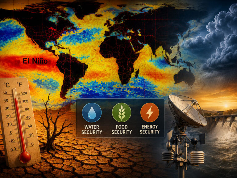
Meteorologists warn a rare Super El Niño could become the strongest in history, bringing extreme weather, floods, droughts, and higher global temperatures.
Meteorologists have warned that a coming El Niño could become a rare ‘Super El Niño’, where the impact of the phenomenon is much more powerful than normal.
El Niño is an event which happens as the sea surface temperature rises, and has a huge impact on tropical and sub-tropical parts of the world, as well as stretching into more temperate areas.
Although El Niño is a naturally occurring phenomenon and is not directly caused by climate change, the impact of climate change may exacerbate the effect of El Niño on both humans and the natural environment when it happens.
El Niño can vary in scale, and impact on weather patterns through the year.

They can alter the direction in which storms travel, as well as affecting hurricane season in parts of the US.
Now, meteorologists from AccuWeather have suggested that this year could be a rare Super El Niño, which could lead to a greater occurrence of extreme weather.
Paul Pastelok is a senior meteorologist at AccuWeather, and explained how this might impact the US over the coming year.
“An El Niño is not a storm,” he said. “It does not affect you directly. It is a cycle that contributes, like many other factors, to produce weather changes and sometimes extremes.”
So it’s less a direct thing, and more an overall condition which can then produce more extreme weather like storms or hurricanes.
A Super El Niño is where these effects are particularly pronounced.
When forecasters examine one region in the tropical Pacific called the Niño 3.4, taking an average surface temperature every three months compared to the average in the long term, a Super El Niño occurs when this goes up 1.5°C.
The National Oceanic and Atmospheric Administration’s (NOAA) Prediction Center has said that there is a two in three chance that the peak of this El Niño will be strong or very strong.
But what impact could a Super El Niño have?
Pastelok said that it could lead to more risk of extreme weather, stating: “The U.S. could see a more active southern storm track this winter, including wetter conditions across parts of the Southern states, warmer conditions across portions of the northern US and an increased risk of weather extremes.”
The impact varies wildly depending on the location, and can include everything from droughts and wildfires to downpours and flooding.
And while it’s not caused by climate change, a Super El Niño can push global temperatures already driven up by human-fuelled climate change higher still, and the stronger the El Niño, the more likely this is.
El Niño is something which occurs on a regular basis, and is based on the surface temperature of the ocean.
This goes through heating and cooling periods, with the heating called El Niño, Spanish for ‘the boy’, and the cooling called La Niña, which means ‘the girl’.
Chad Merrill is also a senior meteorologist at AccuWeather, and said: “In the United States, an El Niño pattern typically brings more rain to the Midwest and parts of the West during the summer.
“It will likely produce extended periods of dry weather from the Gulf Coast to the East Coast but mixed in will be some heavy pockets of rain.”